DC – Washington District of Columbia (D.C.)

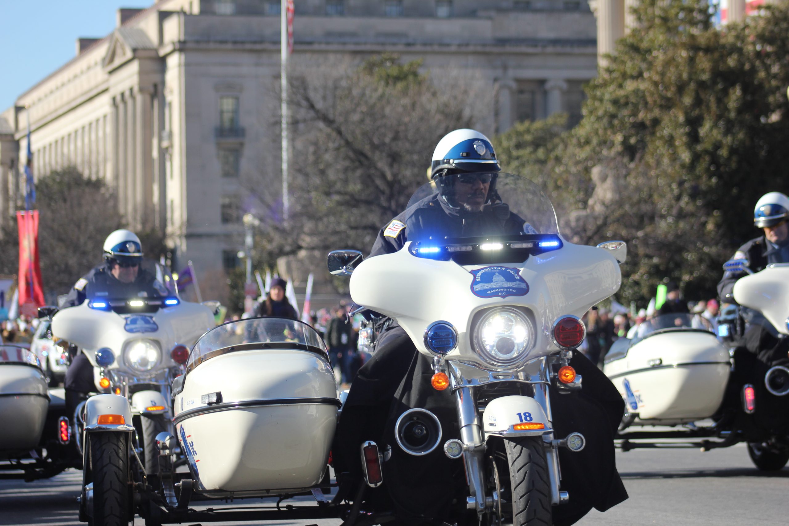
D.C. police on Harley-Davidson motorcycles escort a 2018 protest.

Last updated on June 7, 2025
Airspace
In addition to checking the FAA UAS Facility Map or B4UFLY or SkyVector or Google Maps one should consider also FAA JO 7400.10F – Special Use Airspace which is an order, published yearly, providing a listing of all regulatory and non-regulatory special use airspace areas, as well as issued but not yet implemented amendments to those areas established by the FAA.
Special Use Airspace consists of airspace of defined dimensions identified by an area on the surface of the earth wherein activities must be confined because of their nature, or wherein limitations are imposed upon aircraft operations that are not a part of those activities, or both. The vertical limits of special use airspace are measured by designated altitude floors and ceilings expressed as flight levels or as feet above MSL. Unless otherwise specified, the word “to” (an altitude or flight level) means “to and including” (that altitude or flight level). The horizontal limits of special use airspace are measured by boundaries described by geographic coordinates or other appropriate references that clearly define their perimeter. The period of time during which a designation of special use airspace is in effect is stated in the designation. All bearings and radials in this part are true from point of origin. Unless otherwise specified, all mileages in this part are stated as statute miles.
Restricted Areas: No person may operate an aircraft within a restricted area between the designated altitudes and during the time of designation, unless they have the advance permission of:
(a) The using agency described in § 73.15; or
(b) The controlling agency described in § 73.17.
These using agencies may be the agency, organization, or military command whose activity within a restricted area necessitated the area being so designated. Upon the request of the FAA, the using agency shall execute a letter establishing procedures for joint use of a restricted area by the using agency and the controlling agency, under which the using agency would notify the controlling agency whenever the controlling agency may grant permission for transit through the restricted area in accordance with the terms of the letter. The using agency shall:
(1) Schedule activities within the restricted area;
(2) Authorize transit through, or flight within, the restricted area as feasible; and
(3) Contain within the restricted area all activities conducted therein in accordance with the purpose for which it was designated.
For the purposes of this part, the controlling agency is the FAA facility that may authorize transit through or flight within a restricted area in accordance with a joint-use letter issued under § 73.15.
Prohibited Areas: No person may operate an aircraft within a prohibited area unless authorization has been granted by the using agency. For the purpose of this subpart, the using agency is the agency, organization or military command that established the requirements for the prohibited area.
Military Operations Areas: A Military Operations Area (MOA) is airspace established outside of Class A airspace to separate/segregate certain nonhazardous military activities from IFR traffic and to identify for VFR traffic where these activities are conducted. Activities. MOA’s are established to contain certain military activities such as air combat maneuvers, air intercepts, acrobatics, etc.
Alert Areas: Airspace which may contain a high volume of pilot training activities or an unusual type of aerial activity, neither of which is hazardous to aircraft.
Warning Areas: A non regulatory warning area is airspace of defined dimensions designated over international waters that contains activity which may be hazardous to nonparticipating aircraft. The purpose of such warning areas is to warn nonparticipating pilots of the potential danger. Activities may be hazardous.
National Security Areas: A national security area (NSA) consists of airspace of defined vertical and lateral dimensions established at locations where there is a requirement for increased security of ground facilities. The purpose of such national security areas is to request pilot cooperation by voluntarily avoiding flight through the NSA. When circumstances dictate a need for a greater level of security, flight in an NSA may be temporarily prohibited by regulation under the provisions of 14 CFR Section 99.7, Special Security Instructions. Such prohibitions will be issued by FAA Headquarters and disseminated via the US NOTAM System.
Crewed Aircraft in your Airspace
CREWED AIRCRAFT
Washington DC Drone Regulations
Washington DC government website just for reference.
Washington DC created by US Constitution Article I Section 8 – “The Congress shall have Power To … exercise exclusive Legislation in all Cases whatsoever, over such District (not exceeding ten Miles square) as may, by Cession of particular States, and the Acceptance of Congress, become the Seat of the Government of the United States, and to exercise like Authority over all Places purchased by the Consent of the Legislature of the State in which the Same shall be, for the Erection of Forts, Magazines, Arsenals, dock-Yards, and other needful Buildings;”
US Capitol Police – No drone zone
The Capitol Police Board has established Traffic Regulations for the U.S. Capitol Grounds that detail those activities that are prohibited and rules that are enforced by the U.S. Capitol Police. These regulations provide for the safety of all persons on Capitol Grounds; prevent destruction or damage to Capitol Grounds; preserve healthy and sanitary surroundings; and maintain the Capitol Grounds in an attractive and intact condition for the enjoyment of all visitors.
Chapter 16 of the regulations addresses recreational activities and special restrictions within the U.S. Capitol Grounds.
Specifically, §16.2.90 MODEL ROCKETS and BOATS: strictly prohibits the use of model rockets, remote or manually-controlled model gliders, model airplanes or unmanned aircrafts, model boats and model cars on Capitol Grounds.
DC Area Prohibited & Restricted Airspace
The National Capital Region is governed by a Special Flight Rules Area (SFRA) within a 30-mile radius of Ronald Reagan Washington National Airport, which restricts all flights in the greater DC area.
The SFRA is divided into a 15-mile radius inner ring and a 30-mile radius outer ring.
- Flying an unmanned aircraft within the 15-mile radius inner ring is prohibited without specific FAA authorization.
- Experienced Part 107 and public aircraft operators with justification can file your request through the on-line Access Program (AAP)
- A TSA/FAA waiver and an SGI/COA is required
- Flying a drone for recreational or non-recreational use between 15 and 30 miles from Washington, D.C. is allowed under these operating conditions:
- Aircraft must weigh less than 55 lbs. (including any attachments such as a camera)
- Aircraft must be registered and marked
- Fly below 400 ft.
- Fly within visual line-of-sight
- Fly in clear weather conditions
- Never fly near other aircraft
The airspace around Washington, D.C. is more restricted than in any other part of the country. Rules put in place after the 9/11 attacks establish “national defense airspace” over the area and limit aircraft operations to those with an FAA and Transportation Security Administration authorization. Violators face stiff fines and criminal penalties.
Advanced Air Mobility (AAM) Regulations & Policies
None found by the author.
However, should you, the reader, happen to stumble across something to the contrary, please email the author at FISHE5CA@erau.edu and you may be mentioned in the ACKNOWLEDGEMENTS section of this book by way of thanks for contributing to this free eBook!
Advanced Air Mobility (AAM) News
2024 – VFS to host AAM infrastructure workshop in Washington, D.C.
2023 – Wisk brings autonomous air taxi to heart of Washington, DC
Short Essay Questions
Question 1
You have been hired by a Drone Startup Company. Your boss has immediately assigned this job to you.
They need you to prepare a one-page memo detailing the legalities of using your drone to assist the police in Lincoln Park in the protest, pictured above.
They need you to mention any state laws and local ordinances.
They specifically want to know what airspace (insert pictures) you will be operating in, and whether or not you need an airspace authorization, with or without LAANC capability.
Lastly, there is a bonus for you if, as you scroll through this chapter, you find any typos or broken links!
Question 2
Do the drone laws implicate the First Amendment? If so, describe, citing the exact law.
Question 3
Do the drone laws implicate the Fourth Amendment? Or involve law enforcement officers obtaining warrants? If so, describe, citing the exact law.
Question 4
Do the drone laws contain a preemption clause? If so, describe, citing the exact law.
Question 5
Does DC have UAM/AAM laws? If so, describe, citing the exact law.
Question 6
Are you aware of any new laws or policies not mentioned above? If so, describe, citing the exact law or policy.

.jpg)