MA – Massachusetts

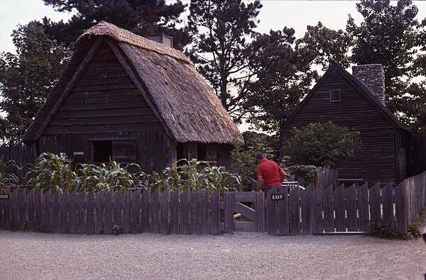
A couple of the dwellings at Plimoth Plantation, a living history museum in Plymouth, Massachusetts that recreates the original English colony of the 17th century.
Photo courtesy of the CIA World Factbook
Massachusetts government website just for reference.
The MADOT website just for reference.
Massachusetts Legislature in case more laws were written since the book was published.

Last updated on March 25, 2024
Airspace
In addition to checking the FAA UAS Facility Map or B4UFLY or SkyVector or Google Maps one should consider also FAA JO 7400.10F – Special Use Airspace which is an order, published yearly, providing a listing of all regulatory and non-regulatory special use airspace areas, as well as issued but not yet implemented amendments to those areas established by the FAA.
Special Use Airspace consists of airspace of defined dimensions identified by an area on the surface of the earth wherein activities must be confined because of their nature, or wherein limitations are imposed upon aircraft operations that are not a part of those activities, or both. The vertical limits of special use airspace are measured by designated altitude floors and ceilings expressed as flight levels or as feet above MSL. Unless otherwise specified, the word “to” (an altitude or flight level) means “to and including” (that altitude or flight level). The horizontal limits of special use airspace are measured by boundaries described by geographic coordinates or other appropriate references that clearly define their perimeter. The period of time during which a designation of special use airspace is in effect is stated in the designation. All bearings and radials in this part are true from point of origin. Unless otherwise specified, all mileages in this part are stated as statute miles.
Restricted Areas: No person may operate an aircraft within a restricted area between the designated altitudes and during the time of designation, unless they have the advance permission of:
(a) The using agency described in § 73.15; or
(b) The controlling agency described in § 73.17.
These using agencies may be the agency, organization, or military command whose activity within a restricted area necessitated the area being so designated. Upon the request of the FAA, the using agency shall execute a letter establishing procedures for joint use of a restricted area by the using agency and the controlling agency, under which the using agency would notify the controlling agency whenever the controlling agency may grant permission for transit through the restricted area in accordance with the terms of the letter. The using agency shall:
(1) Schedule activities within the restricted area;
(2) Authorize transit through, or flight within, the restricted area as feasible; and
(3) Contain within the restricted area all activities conducted therein in accordance with the purpose for which it was designated.
For the purposes of this part, the controlling agency is the FAA facility that may authorize transit through or flight within a restricted area in accordance with a joint-use letter issued under § 73.15.
Prohibited Areas: No person may operate an aircraft within a prohibited area unless authorization has been granted by the using agency. For the purpose of this subpart, the using agency is the agency, organization or military command that established the requirements for the prohibited area.
Military Operations Areas: A Military Operations Area (MOA) is airspace established outside of Class A airspace to separate/segregate certain nonhazardous military activities from IFR traffic and to identify for VFR traffic where these activities are conducted. Activities. MOA’s are established to contain certain military activities such as air combat maneuvers, air intercepts, acrobatics, etc.
Alert Areas: Airspace which may contain a high volume of pilot training activities or an unusual type of aerial activity, neither of which is hazardous to aircraft.
Warning Areas: A non regulatory warning area is airspace of defined dimensions designated over international waters that contains activity which may be hazardous to nonparticipating aircraft. The purpose of such warning areas is to warn nonparticipating pilots of the potential danger. Activities may be hazardous.
National Security Areas: A national security area (NSA) consists of airspace of defined vertical and lateral dimensions established at locations where there is a requirement for increased security of ground facilities. The purpose of such national security areas is to request pilot cooperation by voluntarily avoiding flight through the NSA. When circumstances dictate a need for a greater level of security, flight in an NSA may be temporarily prohibited by regulation under the provisions of 14 CFR Section 99.7, Special Security Instructions. Such prohibitions will be issued by FAA Headquarters and disseminated via the US NOTAM System.
Crewed Aircraft in your Airspace
CREWED AIRCRAFT
City of Chicopee Rules
Chapter 186 – Drones; Regulation of UAS
186-1 – Purpose.
The City of Chicopee recognizes that UA and UAS, commonly referred to as “drones,” are increasingly being flown by citizens for a variety of both recreational and business purposes. US airspace is the busiest in the world with up to 87,000 flights per day, including commercial airliners, flight haulers, air taxis and private and military aircraft. Further, the City of Chicopee is the home of the Westover Air Reserve Base, which conducts flights critical for the protection of all US citizens. Consequently, the City of Chicopee hereby adopts this chapter to protect the privacy and property interests of the residents of the City of Chicopee as well as to comply with all federal and state laws, including the safe operation of the Westover Air Reserve Base.
186-2 – Definitions.
As used in this chapter, the following terms shall have the meanings indicated:
Aircraft – Any object designed or used to navigate or fly in the air.
Drone – Any UA, amateur rocket, model aircraft, rotorcraft (702 CMR 2.01), or similar device or aircraft.
Visual line of sight – An operator having constant and personal visual contact with the aircraft and/or drone at all times. This visual contact shall be natural and personal to the operator and shall not allow the operator to use visual enhancements, screens or other devices to maintain constant visual contact with the aircraft and/or drone.
186-3 – Scope.
This chapter shall apply to all drones and aircraft, as defined herein, to the extent allowed pursuant to state and federal law. This chapter shall be limited to those drones/aircraft that weigh less than 55 pounds and which are flown by a private citizen below 400 feet.
186-4 – Regulations.
A. All aircraft and drones shall comply with all regulations as established by the FAA.
B. A drone and/or aircraft shall only take off and land on private property owned by the operator or where written permission is granted by the landowner. Said written permission shall include the name and signature of the landowner, the address of the property and the permissible dates and hours of operation and shall be in the possession of the drone operator during operation of the drone.
C. All operators who use an aircraft and/or drone for nonbusiness or noncommercial purposes shall also comply with the following regulations:
1. Register with the FAA and maintain proper documentation of the same.
2. As required by federal law, fly below 400 feet at all times.
3. Maintain at all times a visual line of sight of the aircraft and/or drone, as defined above.
4. No operator shall operate an aircraft and/or drone over a crowd or person(s) not directly participating in its operation.
5. No operator shall operate an aircraft and/or drone prior to sunrise or subsequent to sunset.
6. No aircraft and/or drone shall be weaponized.
7. No aircraft or drone shall photograph or videotape any person without the prior written permission of that person. All operators shall maintain this written permission while operating the aircraft and/or drone and for a period of seven years thereafter.
8. No aircraft or drone shall operate over private property without the prior written permission from the landowner, which shall be in the possession of the operator during operation.
9. No aircraft or drone shall operate over any property owned or controlled by the City of Chicopee unless prior written authorization is secured by the operator.
10. No drone shall be flown within five miles of a civilian or military airport without first contacting the control tower before flying.
11. No operator shall operate an aircraft and/or drone in close proximity or near another aircraft.
12. No operator shall operate an aircraft and/or drone in bad weather.
186-5 – Violations and penalties; enforcement.
A. Any person who violates any provision of this chapter shall be subject to the following fine schedule:
1. First offense: written warning.
2. Second offense: fine of $100.
3. Third offense: fine of $250.
4. Fourth or subsequent offense: fine of $300.
B. The City of Chicopee Police Department or their designee shall enforce this chapter.
Massachusetts Department of Conservation and Recreation Rules
Department of Conservation and Recreation
Chapter 84
AN ACT RELATIVE TO THE ENVIRONMENTAL HEALTH OF THE BLUE HILLS RESERVATION.
https://malegislature.gov/Laws/SessionLaws/Acts/2019/Chapter84
Whereas, The deferred operation of this act would tend to defeat its purpose, which is to forthwith provide for the environmental health of the Blue Hills Reservation, therefore it is hereby declared to be an emergency law, necessary for the immediate preservation of the public convenience.______
Be it enacted by the Senate and House of Representatives in General Court assembled, and by the authority of the same, as follows:
SECTION 1. The University of Massachusetts shall select an independent scientific organization to conduct a study and survey of the environmental health of the Blue Hills Reservation, which shall include: (i) the forest, including plant, animal and insect life, and any contributing factors responsible for any decline in forest health; (ii) the effect of ecological and climate change; (iii) the effectiveness of controlled public hunting in culling the deer population; (iv) the effectiveness of the Blue Hills Reservation deer management program in culling the deer population since 2015; and (v) recommendations to ensure improvements in the environmental health of the reservation. The study shall include the physical tagging of deer for purposes of population surveying; provided, however, that methods may include, but shall not be limited to: (i) fixed-wing aircraft or unmanned aerial vehicles using aerial photography and downward-looking thermal imaging; and (ii) distance sampling using driving transects and spotlights.
The University of Massachusetts shall select an independent, scientific organization to conduct the study and survey within 6 months after the effective date of this act and the organization shall report its findings and data in the form of a report and survey, which shall include proposed recommendations and the costs associated with those recommendations, to the department of conservation and recreation and the department of fisheries and wildlife within 4 years following the start of the study.
SECTION 2. This act shall take effect as of July 1, 2019.
Holyoke 54-22
Regulation of UAS (drones).
(a) Purpose. The city recognizes that UA and UAS, commonly referred to as drones, are increasingly being flown by citizens for a variety of both recreational and business purposes. The city further recognizes that model aircraft used for recreational purposes are not currently subject to regulation by the FAA. Accordingly, the city seeks to make sure that all drones are operated in such a manner so as to protect the privacy and property interests of landowners and the city, while at the same time complying with federal and state law requirements.
(b) Definitions. As used in this section:
(1) Aircraft shall be defined as any contrivance invented, used, or designed to navigate, or fly in, the air.
(2) Drone shall be defined collectively as any UA, UAS, model aircraft, rotorcraft or similar device or aircraft.
(3) Model aircraft shall be defined pursuant to section 336 of Public Law 112-95.
(4) Rotorcraft is defined as an aircraft whose support in the air is chiefly derived from the vertical component of the force produced by rotating airfoils. See 702 CMR § 2.01.
(5) UA shall be defined as any UA or UAS that is operated without the possibility of direct human intervention from within or on the aircraft.
(6) UAS shall be defined as an UA and associated elements including communication links and the components that control the UA that are required for the PIC to operate safely and efficiently.
(7) Visual line of sight shall be defined as
(i) the aircraft must be visible at all times to the operator;
(ii) the operator must use his or her own natural own natural vision (which includes vision corrected by standard eyeglasses or contact lenses) to observe the aircraft;
(iii) people other than the operator may not be used in lieu of the operator for maintaining visual line of sight.
(c) Scope. This section shall apply to all drones, as defined herein, to the extent allowed pursuant to state and federal law and regulation. This section shall be limited to those drones that weigh less than 55 pounds and which are flown by private citizens below 400 feet.
(d) Regulated activities and operational limitations.
(1) All drones shall comply with all regulations and operational limitations of the FAA.
(2) A drone may take off from and land on private property owned by the drone operator, and as permitted from such private and public property after having received the prior written consent of that property owner.
(3) Any operator of a drone used for hobby or recreational purposes and not in connection with a business or commercial operation shall also:
- Register with the FAA and comply with all requirements necessary to register.
- Fly at or below 400 feet.
- Maintain at all times a visual line of sight to the drone while operating the drone.
- Not operate over any persons or groups of persons not directly participating in the operation, not under a covered structure, and not inside a covered stationary vehicle.
- Not operate except in daylight-only or civil twilight (30 minutes before official sunrise to 30 minutes after official sunset, Eastern Standard time) with appropriate anti-collision lighting.
- Not photograph or videotape any resident in their own home or on their property without prior written consent of those person or persons.
- Not operate over the private property of another unless prior written consent is obtained from the property owner.
- Not operate over any property owned by the city, including the Holyoke water works and Holyoke gas & electric, unless prior written consent has been obtained from the city, Holyoke water works or Holyoke gas & electric.
(e) Penalties and enforcement. This section shall be enforced by the police. Any violation of this section shall be subject to a non-criminal fine in accordance with M.G.L. ch. 40, § 21D. The penalty for a first offense of this section shall be a written warning; a second offense shall be a $100.00 fine; a third offense shall be a $200.00 fine; and each subsequent offense shall be a $300.00 fine.
Quabbin Reservoir Rules
Unmanned Aerial Vehicles (UAV, or drones) are allowed only by permit.
The use of Unmanned Aerial Vehicles (UAVs or “drones”) is prohibited on the Quabbin Reservoir Watershed System without a DWSP-issued permit specific to a designated location/time, for designated purposes, with an Federal Aviation Administration (FAA) registered UAV, and operated under FAA rules. Watershed Protection Regulations 313 CMR 11.09(2)(a)15 states: “No person except in an emergency, shall bring, land or cause to descend within any Watershed System property any aircraft without written permission from the Commissioner.”
Potential water quality impacts from UAV use include physical and microbial water quality threats from erosion, improperly managed human fecal waste sanitation, chemicals, and behavior such as illegal body/water contact, littering or vandalism. Recent technological advances have made civilian use of UAVs an increasingly popular activity. The unregulated use of UAVs can cause security concerns, public safety and public enjoyment problems, and interfere with wildlife. DWSP will review permit applications for affiliated research projects on a case-by-case basis, provided such proposals do not interfere with security, wildlife functions or public safety.
University Drone Policies
Note: This list is just a sample… many more could be added.
Advanced Air Mobility (AAM)
2021 – MassDOT Aeronautics Division Selected by NASA for an Advanced Air Mobility (AAM)
2023 – Advanced Air Mobility Integration Task Force
Short Essay Questions
Question 1
You have been hired by a Drone Startup Company. Your boss has immediately assigned this job to you.
They need you to prepare a one-page memo detailing the legalities of filming a movie at Plimouth Plantation, a living history museum in Plymouth, Massachusetts, pictured above.
They need you to mention any state laws and local ordinances.
They specifically want to know what airspace you will be operating in, and whether or not you need an airspace authorization, with or without LAANC capability.
Lastly, there is a bonus for you if, as you scroll through this chapter, you find any typos or broken links!
Question 2
Do the state drone laws implicate the First Amendment? If so, describe, citing the exact law.
Question 3
Do the state drone laws implicate the Fourth Amendment? Or involve law enforcement officers obtaining warrants? If so, describe, citing the exact law.
Question 4
Do the state drone laws contain a preemption clause? If so, describe, citing the exact law.
Question 5
Does the state have UAM/AAM laws? If so, describe, citing the exact law.
Question 6
Are you aware of any new laws or policies not mentioned above? If so, describe, citing the exact law or policy.
