PR – Puerto Rico (US)
Five equal horizontal bands of red (top, center, and bottom) alternating with white. A blue isosceles triangle based on the hoist side bears a large, white, five-pointed star in the center; the white star symbolizes Puerto Rico. The three sides of the triangle signify the executive, legislative and judicial parts of the government. Blue stands for the sky and the coastal waters. Red symbolizes the blood shed by warriors, while white represents liberty, victory, and peace.
Flag courtesy of CIA World Factbook
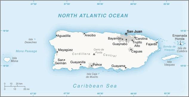
Map courtesy of the CIA World Factbook
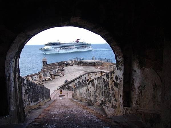
Cruise Ship coming into San Juan Harbor as viewed from the fifth level of El Morro.
Photo courtesy of the CIA World Factbook
Last updated on March 5, 2025
Government
Puerto Rico’s political status is officially described in its 1952 constitution as a “freely associated state” within the federal system of the United States. The U.S. government’s Puerto Rico–Federal Relations Act (1950), which retains many provisions of the earlier Foraker (1900) and Jones (1917) acts, further defines U.S.–Puerto Rican relations. Universal suffrage has been in effect since 1932 (12 years after it was instituted for the continental United States); prior to that time, neither Puerto Rican women nor illiterate males had been allowed to vote. Although Puerto Ricans have been U.S. citizens since 1917, they cannot vote in U.S. presidential elections, but those 18 years and older may vote for a resident commissioner to the U.S. House of Representatives—who is allowed to speak but may vote only in committees. (Thus, Puerto Ricans do not pay federal taxes, because they are without representation.) The commonwealth constitution, which was patterned on its U.S. counterpart, provides for executive, legislative, and judicial branches of government. The constitution may be altered by the commonwealth so long as its articles do not conflict with the U.S. constitution or the Puerto Rico–Federal Relations Act.
Airspace
In addition to checking the FAA UAS Facility Map or B4UFLY or SkyVector or Google Maps one should consider also FAA JO 7400.10F – Special Use Airspace which is an order, published yearly, providing a listing of all regulatory and non-regulatory special use airspace areas, as well as issued but not yet implemented amendments to those areas established by the FAA.
Special Use Airspace consists of airspace of defined dimensions identified by an area on the surface of the earth wherein activities must be confined because of their nature, or wherein limitations are imposed upon aircraft operations that are not a part of those activities, or both. The vertical limits of special use airspace are measured by designated altitude floors and ceilings expressed as flight levels or as feet above MSL. Unless otherwise specified, the word “to” (an altitude or flight level) means “to and including” (that altitude or flight level). The horizontal limits of special use airspace are measured by boundaries described by geographic coordinates or other appropriate references that clearly define their perimeter. The period of time during which a designation of special use airspace is in effect is stated in the designation. All bearings and radials in this part are true from point of origin. Unless otherwise specified, all mileages in this part are stated as statute miles.
Restricted Areas: No person may operate an aircraft within a restricted area between the designated altitudes and during the time of designation, unless they have the advance permission of:
(a) The using agency described in § 73.15; or
(b) The controlling agency described in § 73.17.
These using agencies may be the agency, organization, or military command whose activity within a restricted area necessitated the area being so designated. Upon the request of the FAA, the using agency shall execute a letter establishing procedures for joint use of a restricted area by the using agency and the controlling agency, under which the using agency would notify the controlling agency whenever the controlling agency may grant permission for transit through the restricted area in accordance with the terms of the letter. The using agency shall:
(1) Schedule activities within the restricted area;
(2) Authorize transit through, or flight within, the restricted area as feasible; and
(3) Contain within the restricted area all activities conducted therein in accordance with the purpose for which it was designated.
For the purposes of this part, the controlling agency is the FAA facility that may authorize transit through or flight within a restricted area in accordance with a joint-use letter issued under § 73.15.
Prohibited Areas: No person may operate an aircraft within a prohibited area unless authorization has been granted by the using agency. For the purpose of this subpart, the using agency is the agency, organization or military command that established the requirements for the prohibited area.
Military Operations Areas: A Military Operations Area (MOA) is airspace established outside of Class A airspace to separate/segregate certain nonhazardous military activities from IFR traffic and to identify for VFR traffic where these activities are conducted. Activities. MOA’s are established to contain certain military activities such as air combat maneuvers, air intercepts, acrobatics, etc.
Alert Areas: Airspace which may contain a high volume of pilot training activities or an unusual type of aerial activity, neither of which is hazardous to aircraft.
Warning Areas: A non regulatory warning area is airspace of defined dimensions designated over international waters that contains activity which may be hazardous to nonparticipating aircraft. The purpose of such warning areas is to warn nonparticipating pilots of the potential danger. Activities may be hazardous.
National Security Areas: A national security area (NSA) consists of airspace of defined vertical and lateral dimensions established at locations where there is a requirement for increased security of ground facilities. The purpose of such national security areas is to request pilot cooperation by voluntarily avoiding flight through the NSA. When circumstances dictate a need for a greater level of security, flight in an NSA may be temporarily prohibited by regulation under the provisions of 14 CFR Section 99.7, Special Security Instructions. Such prohibitions will be issued by FAA Headquarters and disseminated via the US NOTAM System.
Drone Regulations
Puerto Rico government website just for reference.
San Juan National Historic Site – Use of Unmanned Aircraft Systems (Drones)
FAA Atlanta Airports District Office covers Puerto Rico.
Advanced Air Mobility (AAM) Regulations & Policies
None found by the author.
However, should you, the reader, happen to stumble across something to the contrary, please email the author at FISHE5CA@erau.edu and you may be mentioned in the ACKNOWLEDGEMENTS section of this book by way of thanks for contributing to this free eBook!
Advanced Air Mobility (AAM) News
None found by the author.
However, should you, the reader, happen to stumble across something to the contrary, please email the author at FISHE5CA@erau.edu and you may be mentioned in the ACKNOWLEDGEMENTS section of this book by way of thanks for contributing to this free eBook!
Short Essay Questions
Question 1
You have been hired by a Drone Startup Company. Your boss has immediately assigned this job to you.
They need you to prepare a one-page memo detailing the legalities of using your drone to film a party on a cruise ship docked at El Morro, pictured above.
They need you to mention any state laws and local ordinances.
They specifically want to know what airspace (insert pictures) you will be operating in, and whether or not you need an airspace authorization, with or without LAANC capability.
Lastly, there is a bonus for you if, as you scroll through this chapter, you find any typos or broken links!
Question 2
Do you need a certificate to fly UAS?
If so, how do you obtain one?
Are there fees associated with this?
If so, how much?
Question 3
May you operate beyond visual line of sight?
If so, what procedures must you follow?
Question 4
Does the country have UAM/AAM laws? If so, describe, citing the exact law.
Question 5
Are you aware of any new laws or policies not mentioned above? If so, describe, citing the exact law or policy.
