GU – Guam (US)

Territorial flag is dark blue with a narrow red border on all four sides. Centered is a red-bordered, pointed, vertical ellipse containing a beach scene, a proa or outrigger canoe with sail, and a palm tree with the word GUAM superimposed in bold red letters. The proa is sailing in Agana Bay with the promontory of Punta Dos Amantes, near the capital, in the background. The shape of the central emblem is that of a Chamorro sling stone, used as a weapon for defense or hunting. Blue represents the sea and red the blood shed in the struggle against oppression.
Flag courtesy of CIA World Factbook
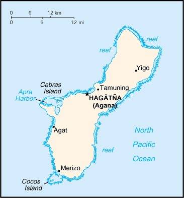
Map courtesy of the CIA World Factbook
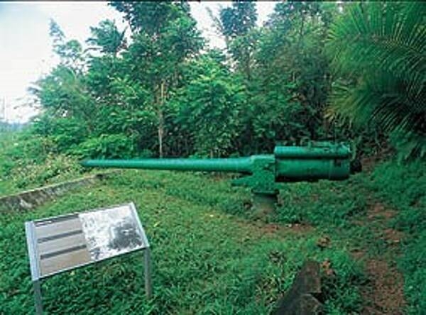
The Piti Guns unit of the War in the Pacific National Historical Park is the site of three Vickers type Model 3 140mm coastal defense guns. During the Japanese occupation of Guam from 1941-1944, the Chamorro population was forced to work in building up these defenses.
Photo courtesy of the CIA World Factbook
Last updated on March 5, 2025
Government
Guam is an unincorporated territory of the United States governed under the Organic Act of Guam, passed by the U.S. Congress and approved by the president on August 1, 1950. The Organic Act made all Chamorros U.S. citizens. Although they do not have the right to vote in national elections, voters do caucus during the presidential primary season and send delegates to the Democratic and Republican national party conventions.
A 1968 amendment to the Organic Act provides for the popular election of a governor and lieutenant governor to four-year terms. All persons age 18 years or older are permitted to vote. The legislature is a unicameral body with 15 senators directly elected at large for a term of two years. Guam also elects a delegate to the U.S. House of Representatives for a term of two years; that delegate has limited voting rights that exclude the ability to vote on the final passage of legislation.
The people of Guam voted in 1982 in favor of pursuing a commonwealth relationship similar to that established in the Northern Marianas. A draft Commonwealth Act was approved in 1987, and negotiations with the U.S. Congress were initiated.
The highest appellate court is the Guam Supreme Court. There is also a District Court of Guam, whose judge is appointed by the U.S. president for a term of eight years. There are two levels of local trial courts: the Superior Court of Guam, for criminal and civil cases, and the traffic, juvenile, and small-claims courts. Judges are appointed by the governor with consent of the legislature and are reconfirmed by majority public vote every four years. Appeals may be made to the U.S. Court of Appeals for the Ninth Circuit and to the U.S. Supreme Court.
Each of the island’s villages is headed by a popularly elected mayor. The mayors and vice mayors form the Mayors’ Council of Guam, which makes recommendations regarding administrative and fiscal policies and acts as a liaison between the three branches of government, the military communities, and U.S. federal agencies.
Airspace
In addition to checking the FAA UAS Facility Map or B4UFLY or SkyVector or Google Maps one should consider also FAA JO 7400.10F – Special Use Airspace which is an order, published yearly, providing a listing of all regulatory and non-regulatory special use airspace areas, as well as issued but not yet implemented amendments to those areas established by the FAA.
Special Use Airspace consists of airspace of defined dimensions identified by an area on the surface of the earth wherein activities must be confined because of their nature, or wherein limitations are imposed upon aircraft operations that are not a part of those activities, or both. The vertical limits of special use airspace are measured by designated altitude floors and ceilings expressed as flight levels or as feet above MSL. Unless otherwise specified, the word “to” (an altitude or flight level) means “to and including” (that altitude or flight level). The horizontal limits of special use airspace are measured by boundaries described by geographic coordinates or other appropriate references that clearly define their perimeter. The period of time during which a designation of special use airspace is in effect is stated in the designation. All bearings and radials in this part are true from point of origin. Unless otherwise specified, all mileages in this part are stated as statute miles.
Restricted Areas: No person may operate an aircraft within a restricted area between the designated altitudes and during the time of designation, unless they have the advance permission of:
(a) The using agency described in § 73.15; or
(b) The controlling agency described in § 73.17.
These using agencies may be the agency, organization, or military command whose activity within a restricted area necessitated the area being so designated. Upon the request of the FAA, the using agency shall execute a letter establishing procedures for joint use of a restricted area by the using agency and the controlling agency, under which the using agency would notify the controlling agency whenever the controlling agency may grant permission for transit through the restricted area in accordance with the terms of the letter. The using agency shall:
(1) Schedule activities within the restricted area;
(2) Authorize transit through, or flight within, the restricted area as feasible; and
(3) Contain within the restricted area all activities conducted therein in accordance with the purpose for which it was designated.
For the purposes of this part, the controlling agency is the FAA facility that may authorize transit through or flight within a restricted area in accordance with a joint-use letter issued under § 73.15.
Prohibited Areas: No person may operate an aircraft within a prohibited area unless authorization has been granted by the using agency. For the purpose of this subpart, the using agency is the agency, organization or military command that established the requirements for the prohibited area.
Military Operations Areas: A Military Operations Area (MOA) is airspace established outside of Class A airspace to separate/segregate certain nonhazardous military activities from IFR traffic and to identify for VFR traffic where these activities are conducted. Activities. MOA’s are established to contain certain military activities such as air combat maneuvers, air intercepts, acrobatics, etc.
Alert Areas: Airspace which may contain a high volume of pilot training activities or an unusual type of aerial activity, neither of which is hazardous to aircraft.
Warning Areas: A non regulatory warning area is airspace of defined dimensions designated over international waters that contains activity which may be hazardous to nonparticipating aircraft. The purpose of such warning areas is to warn nonparticipating pilots of the potential danger. Activities may be hazardous.
National Security Areas: A national security area (NSA) consists of airspace of defined vertical and lateral dimensions established at locations where there is a requirement for increased security of ground facilities. The purpose of such national security areas is to request pilot cooperation by voluntarily avoiding flight through the NSA. When circumstances dictate a need for a greater level of security, flight in an NSA may be temporarily prohibited by regulation under the provisions of 14 CFR Section 99.7, Special Security Instructions. Such prohibitions will be issued by FAA Headquarters and disseminated via the US NOTAM System.
Drone Regulations
Guam government website just for reference.
Guam Airport for reference.
Advanced Air Mobility (AAM) Regulations & Policies
None found by the author.
However, should you, the reader, happen to stumble across something to the contrary, please email the author at FISHE5CA@erau.edu and you may be mentioned in the ACKNOWLEDGEMENTS section of this book by way of thanks for contributing to this free eBook!
Advanced Air Mobility (AAM) News
None found by the author.
However, should you, the reader, happen to stumble across something to the contrary, please email the author at FISHE5CA@erau.edu and you may be mentioned in the ACKNOWLEDGEMENTS section of this book by way of thanks for contributing to this free eBook!
Short Essay Questions
Question 1
You have been hired by a Drone Startup Company. Your boss has immediately assigned this job to you.
They need you to prepare a one-page memo detailing the legalities of filming at the Pacific National Historical Park, pictured above.
They need you to mention any state laws and local ordinances.
They specifically want to know what airspace (insert pictures) you will be operating in, and whether or not you need an airspace authorization, with or without LAANC capability.
Lastly, there is a bonus for you if, as you scroll through this chapter, you find any typos or broken links!
Question 2
Do you need a certificate to fly UAS?
If so, how do you obtain one?
Are there fees associated with this?
If so, how much?
Question 3
May you operate beyond visual line of sight?
If so, what procedures must you follow?
Question 4
Does the country have UAM/AAM laws? If so, describe, citing the exact law.
Question 5
Are you aware of any new laws or policies not mentioned above? If so, describe, citing the exact law or policy.
