40 Marshall Islands
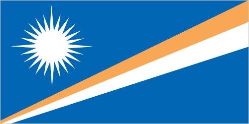
Blue with two stripes radiating from the lower hoist-side corner – orange (top) and white. A white star with four large rays and 20 small rays appears on the hoist side above the two stripes. Blue represents the Pacific Ocean, the orange stripe signifies the Ralik Chain or sunset and courage, while the white stripe signifies the Ratak Chain or sunrise and peace. The star symbolizes the cross of Christianity, each of the 24 rays designates one of the electoral districts in the country and the four larger rays highlight the principal cultural centers of Majuro, Jaluit, Wotje, and Ebeye. The rising diagonal band can also be interpreted as representing the equator, with the star showing the archipelago’s position just to the north.
Flag courtesy of the CIA World Factbook
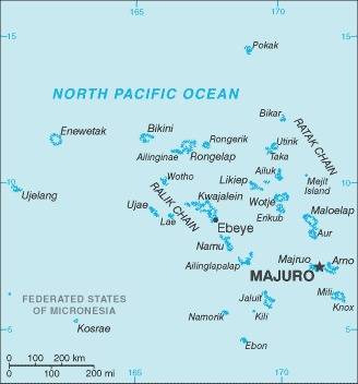
Map courtesy of the CIA World Factbook
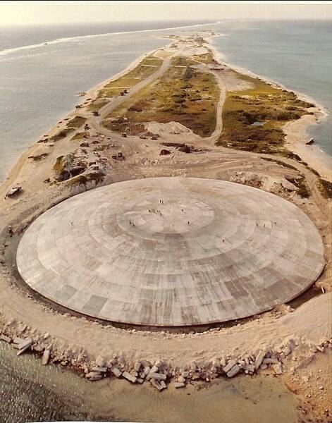
Aerial view of Runit Dome (or Cactus Dome) on Runit Island in Enewetak Atoll. Between 1977 and 1980, the crater created by the Cactus shot of Operation Hardtack I was used as a burial pit to inter 84,000 cubic meters of radioactive soil scraped from the various contaminated Enewetak Atoll islands. The Runit Dome was built to cover the material.
Photo courtesy of the CIA World Factbook
Government
According to Britannica, under the constitution adopted in 1979, the government consists of a president elected by a unicameral, 33-member parliament known as the Nitijela. The Council of Iroij (Chiefs) has mainly a consultative function, concerned with traditional laws and customs. Hospitals on Majuro and Ebeye (part of Kwajalein Atoll) and dispensaries on other islands provide health care. There are primary schools, both public and church-run, on the inhabited islands and islets. Majuro and Jaluit atolls each have a public secondary school. Majuro is also the site of the College of the Marshall Islands (1993), which grants certificates and associate degrees in a variety of programs.
Civil / National Aviation Authority (CAA/NAA)
The Directorate of Civil Aviation of the Marshall Islands was established in 2003 under the Minister of Transportation and Communication. RMIPA – Republic of the Marshall Islands Port Authority
Airspace
SkyVector – Google Maps – ADS-B Exchange
ICAO countries publish an Aeronautical Information Publication (AIP). This document is divided into three parts: General (GEN), En Route (ENR) and Aerodromes (AD). ENR 1.4 details the types of airspace classes they chose to adopt from classes A through G. Marshall Islands AIP
Drone Regulations
Currently, there is no legal framework for the use of drones.
Advanced Air Mobility (AAM)
Short Essay Questions
Question 1
You have been hired by a Drone Startup Company. Your boss has immediately assigned this job to you.
They need you to prepare a one-page memo detailing the legalities of using a drone over Cactus Dome, pictured above.
They need you to mention any national laws and local ordinances.
They specifically want to know what airspace you will be operating in and whether or not you need an airspace authorization.
Does it matter whether or not you are a citizen of the country?
Lastly, there is a bonus for you if, as you scroll through this chapter, you find any typos or broken links!
Question 2
Do you need a certificate to fly UAS?
If so, how do you obtain one?
Are there fees associated with this?
If so, how much?
Question 3
May you operate beyond visual line of sight?
If so, what procedures must you follow?
Question 4
Does the country have UAM/AAM laws? If so, describe, citing the exact law.
Question 5
Are you aware of any new laws or policies not mentioned above? If so, describe, citing the exact law or policy.
