HI – Hawaii

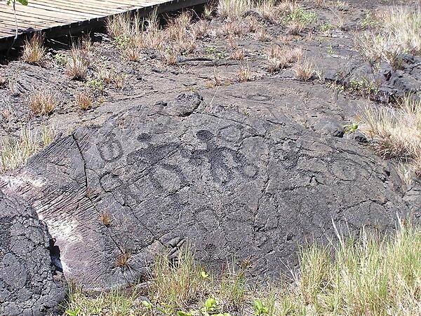
Petroglyphs at Hawaii Volcanoes National Park on the Big Island.
Photo courtesy of the CIA World Factbook
Hawaii government website just for reference.
The HIDOT website just for reference.
Hawaii Legislature in case more laws were written since this book was published.

Last updated on March 22, 2024
Airspace
In addition to checking the FAA UAS Facility Map or B4UFLY or SkyVector or Google Maps one should consider also FAA JO 7400.10F – Special Use Airspace which is an order, published yearly, providing a listing of all regulatory and non-regulatory special use airspace areas, as well as issued but not yet implemented amendments to those areas established by the FAA.
Special Use Airspace consists of airspace of defined dimensions identified by an area on the surface of the earth wherein activities must be confined because of their nature, or wherein limitations are imposed upon aircraft operations that are not a part of those activities, or both. The vertical limits of special use airspace are measured by designated altitude floors and ceilings expressed as flight levels or as feet above MSL. Unless otherwise specified, the word “to” (an altitude or flight level) means “to and including” (that altitude or flight level). The horizontal limits of special use airspace are measured by boundaries described by geographic coordinates or other appropriate references that clearly define their perimeter. The period of time during which a designation of special use airspace is in effect is stated in the designation. All bearings and radials in this part are true from point of origin. Unless otherwise specified, all mileages in this part are stated as statute miles.
Restricted Areas: No person may operate an aircraft within a restricted area between the designated altitudes and during the time of designation, unless they have the advance permission of:
(a) The using agency described in § 73.15; or
(b) The controlling agency described in § 73.17.
These using agencies may be the agency, organization, or military command whose activity within a restricted area necessitated the area being so designated. Upon the request of the FAA, the using agency shall execute a letter establishing procedures for joint use of a restricted area by the using agency and the controlling agency, under which the using agency would notify the controlling agency whenever the controlling agency may grant permission for transit through the restricted area in accordance with the terms of the letter. The using agency shall:
(1) Schedule activities within the restricted area;
(2) Authorize transit through, or flight within, the restricted area as feasible; and
(3) Contain within the restricted area all activities conducted therein in accordance with the purpose for which it was designated.
For the purposes of this part, the controlling agency is the FAA facility that may authorize transit through or flight within a restricted area in accordance with a joint-use letter issued under § 73.15.
Prohibited Areas: No person may operate an aircraft within a prohibited area unless authorization has been granted by the using agency. For the purpose of this subpart, the using agency is the agency, organization or military command that established the requirements for the prohibited area.
Military Operations Areas: A Military Operations Area (MOA) is airspace established outside of Class A airspace to separate/segregate certain nonhazardous military activities from IFR traffic and to identify for VFR traffic where these activities are conducted. Activities. MOA’s are established to contain certain military activities such as air combat maneuvers, air intercepts, acrobatics, etc.
Alert Areas: Airspace which may contain a high volume of pilot training activities or an unusual type of aerial activity, neither of which is hazardous to aircraft.
Warning Areas: A non regulatory warning area is airspace of defined dimensions designated over international waters that contains activity which may be hazardous to nonparticipating aircraft. The purpose of such warning areas is to warn nonparticipating pilots of the potential danger. Activities may be hazardous.
National Security Areas: A national security area (NSA) consists of airspace of defined vertical and lateral dimensions established at locations where there is a requirement for increased security of ground facilities. The purpose of such national security areas is to request pilot cooperation by voluntarily avoiding flight through the NSA. When circumstances dictate a need for a greater level of security, flight in an NSA may be temporarily prohibited by regulation under the provisions of 14 CFR Section 99.7, Special Security Instructions. Such prohibitions will be issued by FAA Headquarters and disseminated via the US NOTAM System.
Crewed Aircraft in your Airspace
CREWED AIRCRAFT
Hawaii Revised Statute §132D-20
Enforcement; probable cause for arrest.
(a) This chapter shall be enforced by each county. The counties are authorized to enforce and administer the provisions of this chapter.
(b) Arrests for offenses under this chapter or under a county fireworks ordinance shall be made in compliance with chapter 803. The facts and circumstances to establish probable cause for an arrest may include but are not limited to:
(1) Statements from individuals who witnessed the offense, even if those individuals are not law enforcement officers; and
(2) Photographs, video recordings, or other recordings that show the commission of the offense and can be authenticated by one or more witnesses; provided that a recording made using an UAV shall be exempt from the requirement of authentication by one or more witnesses. For the purposes of this subsection:
“Other recording” includes any photograph, or a video made using an UAV.
“Unmanned aerial vehicle” means any aerial vehicle that is operated without the possibility of direct human intervention within or on the aerial vehicle. The term UAV does not include a remote-controlled airplane.
Harbor Master Notice HMN-M 02-22
Harbor Master Notice HMN-M 02-22
HARBOR MASTER NOTICE NO. HMN-M 02.22 DRONES – AERONAUTICAL AND MARINE EFFECTIVE SEPTEMBER 23, 2021
In accordance with the State of Hawaii, Department of Transportation Harbors Division, Hawaii Administrative Rules (HAR), Chapter §19-41-1, this notice encompasses the areas within the scope of the State DOT Commercial Harbors of Kahului (Maui), Kaunakakai (Molokai), Kaumalapau (Lanai) and Hana (Maui).
Recreational drones of any type, aeronautical (Unmanned Aircraft Systems – UAS) and marine, are strictly prohibited.
AERONAUTICAL DRONE
Requests for commercial operation of an UAS, aeronautical drone over any State of Hawaii DOT Harbors Division property must be received by the Harbor Master a minimum of fourteen (14) days prior to the intended operations and must include the following:
- Flight plan, date, time, company/contractor.
- Letter from the company granting permission for the UAS operation.
- FAA granted 333 Exemption or any other FAA requirements or other government regulatory agency.
- Evidence of UAS registration with the FAA.
o Make/Model of UAS
o Registration #
o Total weight of UAS, including camera.
- The operator’s airman’s certificate.
- Certificates of Insurance for the use of the UAS:
o UAS insurance with minimum $2,000,000 liability per occurrence with the following separate endorsements:
1. Policy endorsement of UAS coverage for owned and unowned aircraft;
2. Policy endorsement naming the “State of Hawaii, all departments, attached agencies, officers, employees, and agents” as Additional Insured.
General Operations:
– UAS must remain within line of sight of operator, or a visual observer.
– Operator must be at least 21 years of age.
– Daytime operations only or within civil twilight (30 minutes before official sunrise and 30 minutes after official sunset) and only in good weather, (light winds, no rain).
– Maximum height of 200 feet AGL (Above Ground Level).
– Maximum UAS weight of 55 pounds, total weight.
– Maximum speed of 100 MPH (Miles Per Hour).
– Yield to manned aircraft.
– Strictly prohibited from flying over people or non-client vessel or in a reckless manner.
– Operate only in the area authorized by the Harbor Master.
– Prohibited from operating from a moving vehicle/vessel.
– Single UAS operation, prohibited from operating multiple small UAS.
Hawaii State Park Rules
No drones
The use, launching or landing of drones or other types of aircraft is prohibited.
Midway Atoll National Wildlife Refuge Rules
Launching, landing or disturbing wildlife by aircraft (drones) on national wildlife refuges is prohibited. Drone operators should not rely solely on applications such as AirMap, DJI Go or B4UFly to determine if a location is legal for drone use. Such applications do not always capture accurate locations of public lands where drones are prohibited. Contact the refuge manager if you have questions. The use of drones on or from refuge-administered lands for the purpose of taking commercial photography requires a permit in accordance with 43 CFR 5.1-12
Midway Island Airport Rules
Midway Island Airport – in case you need to contact the airport manager.
National Marine Sanctuaries Rules
Overflight regulations within Olympic Coast, Greater Farallones, Monterey Bay and Channel Islands National Marine Sanctuaries require that motorized aircraft maintain minimum altitudes above specified coastal waters. Failure to comply with these minimum altitude limits is presumed to disturb marine mammals and seabirds and is a violation of federal regulations for the sanctuaries.
There are limited ways to access the Papahanaumokuakea Monument for specific purposes, such as to conduct cultural practices and research, habitat restoration and scientific work, and to develop educational and media products. See Permitting for application details.
Oahu Harbor Master Notice 3-17
Oahu Harbor Master Notice 3-17
Effective September 1, 2017, in accordance with the State of Hawaii, DOT Harbors Division Hawaii Administrative Rules chapter 19-41-1 this notice encompasses the area within the scope of the state commercial harbors.
Recreational drones of any type, aeronautical (UAS) and marine, is strictly prohibited.
Aeronautical Drone
Requests for commercial operation of an UAS, aeronautical drone over any State of Hawaii DOT-Harbor property must be received by the Harbor Master 14 days prior to the intended operations and must include the following:
– Flight plan, date, time, company/contractor
– Letter from the company granting permission for the UAS operation
– Granted 333 Exemption or any other FAA requirements or other government regulatory agency
– Evidence of UAS registration with the FAA
o Make/model of UAS
o Registration number
o Total weight of UAS, including camera
– The operator’s airman’s certificate
– Certificates of insurance for the use of the UAS:
o UAS insurance with minimum $2,000,000 liability per occurrence with the following separate endorsements;
- Policy endorsement of UAS coverage for owned and unowned aircraft;
- Policy endorsement naming the “State of Hawaii, all departments, attached agencies, officers, employees and agents” as Additional Insured.
General operations:
– Operate within the provisions of the 333 Exemption
– UAS must remain within line of sight of operator, or a visual observer
– Operator must be at least 21 years of age
– Daytime operations only or within civil twilight (30 minutes before official sunrise and 30 minutes after official sunset) and only in good weather (light winds, no rain).
– Maximum height of 200 feet AGL
– Maximum UAS weight of 55 pounds, total weight
– Maximum speed of 100 mph
– Yield to manned aircraft
– Strictly prohibited from flying over people or non-client vessel or in a reckless manner
– Operate only in the area authorized by the Harbor Master
– Prohibited from operating from a moving vehicle/vessel
– Single UAS operation, prohibited from operating multiple SUAS
University Drone Policies
Note: This list is just a sample… many more could be added.
Advanced Air Mobility (AAM)
2022 – Regent signs accords to bring AAM seaglider flights to Hawaii
Short Essay Questions
Question 1
You have been hired by a Drone Startup Company. Your boss has immediately assigned this job to you.
They need you to prepare a one-page memo detailing the legalities of filming a birthday party at Hawaii Volcanoes National Park on the Big Island, pictured above.
They need you to mention any state laws and local ordinances.
They specifically want to know what airspace you will be operating in, and whether or not you need an airspace authorization, with or without LAANC capability.
Lastly, there is a bonus for you if, as you scroll through this chapter, you find any typos or broken links!
Question 2
Do the state drone laws implicate the First Amendment? If so, describe, citing the exact law.
Question 3
Do the state drone laws implicate the Fourth Amendment? Or involve law enforcement officers obtaining warrants? If so, describe, citing the exact law.
Question 4
Do the state drone laws contain a preemption clause? If so, describe, citing the exact law.
Question 5
Does the state have UAM/AAM laws? If so, describe, citing the exact law.
Question 6
Are you aware of any new laws or policies not mentioned above? If so, describe, citing the exact law or policy.
