MD – Maryland

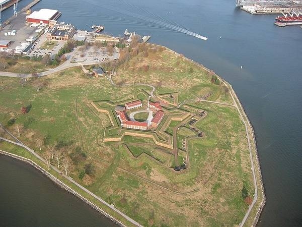
Aerial view of Fort McHenry National Monument and Historic Shrine in Baltimore, Maryland showing the entire tip of Locust Point.
Photo courtesy of the CIA World Factbook
Maryland government website just for reference.
The MDDOT website just for reference.
Maryland Legislature in case more laws were written since this book was published.

Last updated on April 2, 2024
Airspace
In addition to checking the FAA UAS Facility Map or B4UFLY or SkyVector or Google Maps one should consider also FAA JO 7400.10F – Special Use Airspace which is an order, published yearly, providing a listing of all regulatory and non-regulatory special use airspace areas, as well as issued but not yet implemented amendments to those areas established by the FAA.
Special Use Airspace consists of airspace of defined dimensions identified by an area on the surface of the earth wherein activities must be confined because of their nature, or wherein limitations are imposed upon aircraft operations that are not a part of those activities, or both. The vertical limits of special use airspace are measured by designated altitude floors and ceilings expressed as flight levels or as feet above MSL. Unless otherwise specified, the word “to” (an altitude or flight level) means “to and including” (that altitude or flight level). The horizontal limits of special use airspace are measured by boundaries described by geographic coordinates or other appropriate references that clearly define their perimeter. The period of time during which a designation of special use airspace is in effect is stated in the designation. All bearings and radials in this part are true from point of origin. Unless otherwise specified, all mileages in this part are stated as statute miles.
Restricted Areas: No person may operate an aircraft within a restricted area between the designated altitudes and during the time of designation, unless they have the advance permission of:
(a) The using agency described in § 73.15; or
(b) The controlling agency described in § 73.17.
These using agencies may be the agency, organization, or military command whose activity within a restricted area necessitated the area being so designated. Upon the request of the FAA, the using agency shall execute a letter establishing procedures for joint use of a restricted area by the using agency and the controlling agency, under which the using agency would notify the controlling agency whenever the controlling agency may grant permission for transit through the restricted area in accordance with the terms of the letter. The using agency shall:
(1) Schedule activities within the restricted area;
(2) Authorize transit through, or flight within, the restricted area as feasible; and
(3) Contain within the restricted area all activities conducted therein in accordance with the purpose for which it was designated.
For the purposes of this part, the controlling agency is the FAA facility that may authorize transit through or flight within a restricted area in accordance with a joint-use letter issued under § 73.15.
Prohibited Areas: No person may operate an aircraft within a prohibited area unless authorization has been granted by the using agency. For the purpose of this subpart, the using agency is the agency, organization or military command that established the requirements for the prohibited area.
Military Operations Areas: A Military Operations Area (MOA) is airspace established outside of Class A airspace to separate/segregate certain nonhazardous military activities from IFR traffic and to identify for VFR traffic where these activities are conducted. Activities. MOA’s are established to contain certain military activities such as air combat maneuvers, air intercepts, acrobatics, etc.
Alert Areas: Airspace which may contain a high volume of pilot training activities or an unusual type of aerial activity, neither of which is hazardous to aircraft.
Warning Areas: A non regulatory warning area is airspace of defined dimensions designated over international waters that contains activity which may be hazardous to nonparticipating aircraft. The purpose of such warning areas is to warn nonparticipating pilots of the potential danger. Activities may be hazardous.
National Security Areas: A national security area (NSA) consists of airspace of defined vertical and lateral dimensions established at locations where there is a requirement for increased security of ground facilities. The purpose of such national security areas is to request pilot cooperation by voluntarily avoiding flight through the NSA. When circumstances dictate a need for a greater level of security, flight in an NSA may be temporarily prohibited by regulation under the provisions of 14 CFR Section 99.7, Special Security Instructions. Such prohibitions will be issued by FAA Headquarters and disseminated via the US NOTAM System.
Crewed Aircraft in your Airspace
CREWED AIRCRAFT
Maryland Statute 14-301
Article – Economic Development
(a) (1) In this section the following words have the meanings indicated.
(2) “Unmanned aircraft” means the flying portion of an UAS, flown by a pilot via a ground control system, or autonomously through use of an onboard computer, a communication link, and any additional equipment that is necessary for the UA to operate safely.
(3) “Unmanned aircraft system” means an UA and all the associated support equipment, control stations, data links, telemetry, communications and navigation equipment, and other equipment necessary to operate the UA.
State Preemption
(1) preempts the authority of a county or municipality to prohibit, restrict, or regulate the testing or operation of UAS; and
(2) supersedes any existing law or ordinance of a county or municipality that prohibits, restricts, or regulates the testing or operation of UAS.
Maryland Statute 14-302
(a) The Department and the DOT, including the Maryland Aviation Administration, shall:
(1) monitor the FAA for any proposed regulations or rulemaking that relate to the regulation of the operation of small commercial unmanned aircraft systems;
(2) determine the impact of any proposed regulations or rulemaking on the State; and
(3) determine whether it is in the public interest for the State to consider statewide legislation relating to the regulation of the operation of unmanned aircraft systems.
(b) In determining the findings under subsection (a) of this section, the Department and the DOT, including the Maryland Aviation Administration, shall consult with:
(1) the University of Maryland, in its role as a member of the Mid– Atlantic Aviation Partnership;
(2) county and municipal governments; and
(3) other interested parties that the Department or the DOT, including the Maryland Aviation Administration, determine appropriate.
(c) If the Department and the DOT, including the Maryland Aviation Administration, determine that any proposed regulations or rulemaking that relate to the regulation of the operation of small commercial unmanned aircraft have been or are likely to be adopted by the FAA, as soon as practicably possible, the Department and the DOT, including the Maryland Aviation Administration, shall report any findings and recommendations to the Governor and, in accordance with § 2–1257 of the State Government Article, the General Assembly.
Carroll County Code 94.060
94.060 REMOTE CONTROL UNMANNED AIRCRAFT AND MODEL ROCKETS.
Use of remote control unmanned aircraft and model rockets requires approval by the Manager, including the location and schedule of usage.
Penalty, see § 94.999
Frederick County Parks and Recreation Rules
Frederick County Parks and Recreation
Drones are allowed through completion of a Special Request Form and only allowed in designated parks/areas, following all regulations. Those parks include Catoctin Creek Nature Center, Kemptown Park, Middletown Park, Old National Pike Park, and Utica District Park. All FAA rules and regulations apply to flying drones on Frederick County Park property.
Maryland State Park Policy
Operation of Drones: UAS, commonly referred to as UAVs or drones, operated by persons on lands owned and managed by the Department of Natural Resources must be in compliance with all FAA regulations, as well as all State and federal laws, including all Use of State Parks regulations. To ensure compliance with those regulations, and that the operation of the drone does not jeopardize public safety or the protection of park resources, all drone operators must contact the Park Manager prior to flying a drone in a State Park. Drone pilots are responsible for knowing and complying with all FAA regulations.
UAS in the State of Maryland Report
UAS in the State of Maryland Report
The Unmanned Aircraft Systems Research, Development, Regulation and Privacy Act of 2015 was enacted by the Maryland General Assembly (CH 164, Acts of 2015) and signed into law by Governor Larry Hogan on 12 May 2015. Section 5 of the Act requires the preparation of a report by the Maryland Department of State Police, the Maryland Department of Transportation Maryland Aviation Administration, local law enforcement officials, and other appropriate local government officials to be submitted on or before 31 December 2018 to the Governor and the General Assembly. The report must include the following:
• Findings from a review of the state of Unmanned Aircraft System (UAS) recreational use including incidents or patterns that interfere with state or local public safety efforts or sensitive areas or facilities; and
• Recommendations regarding changes to State law or local regulatory authority needed to support governance or enforcement efforts related to unmanned aircraft systems.
The Maryland Department of State Police (MDSP) and the Maryland Department of Transportation Maryland Aviation Administration (MDOT MAA), in partnership with the Maryland Coordination and Analysis Center, University of Maryland UAS Test Site, and other local and state agencies gathered, analyzed and presented findings regarding incidents and patterns on small UAS (sUAS) activities in accordance with the guidance in Section 5 of the Act.
University Drone Policies
St. John’s College (same as New Mexico)
St. Mary’s College of Maryland
University of Maryland Baltimore County
Note: This list is just a sample… many more could be added.
Advanced Air Mobility (AAM)
2024 – Beta Technologies, Signature Aviation to Install Electric Aircraft Chargers at 3 Airports
Short Essay Questions
Question 1
You have been hired by a Drone Startup Company. Your boss has immediately assigned this job to you.
They need you to prepare a one-page memo detailing the legalities of filming a war re-enactment at Fort McHenry National Monument, pictured above.
They need you to mention any state laws and local ordinances.
They specifically want to know what airspace you will be operating in, and whether or not you need an airspace authorization, with or without LAANC capability.
Lastly, there is a bonus for you if, as you scroll through this chapter, you find any typos or broken links!
Question 2
Do the state drone laws implicate the First Amendment? If so, describe, citing the exact law.
Question 3
Do the state drone laws implicate the Fourth Amendment? Or involve law enforcement officers obtaining warrants? If so, describe, citing the exact law.
Question 4
Do the state drone laws contain a preemption clause? If so, describe, citing the exact law.
Question 5
Does the state have UAM/AAM laws? If so, describe, citing the exact law.
Question 6
Are you aware of any new laws or policies not mentioned above? If so, describe, citing the exact law or policy.
