NC – North Carolina

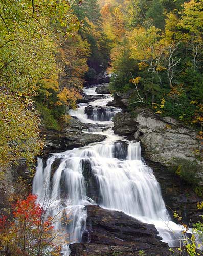
Cullasaja Falls in Macon County

Last updated on October 7, 2025
Airspace
In addition to checking the FAA UAS Facility Map or SkyVector or Google Maps one should consider also FAA JO 7400.10G – Special Use Airspace which is an order, published yearly, providing a listing of all regulatory and non-regulatory special use airspace areas, as well as issued but not yet implemented amendments to those areas established by the FAA.
Special Use Airspace consists of airspace of defined dimensions identified by an area on the surface of the earth wherein activities must be confined because of their nature, or wherein limitations are imposed upon aircraft operations that are not a part of those activities, or both. The vertical limits of special use airspace are measured by designated altitude floors and ceilings expressed as flight levels or as feet above MSL. Unless otherwise specified, the word “to” (an altitude or flight level) means “to and including” (that altitude or flight level). The horizontal limits of special use airspace are measured by boundaries described by geographic coordinates or other appropriate references that clearly define their perimeter. The period of time during which a designation of special use airspace is in effect is stated in the designation. All bearings and radials in this part are true from point of origin. Unless otherwise specified, all mileages in this part are stated as statute miles.
Restricted Areas: No person may operate an aircraft within a restricted area between the designated altitudes and during the time of designation, unless they have the advance permission of:
(a) The using agency described in § 73.15; or
(b) The controlling agency described in § 73.17.
These using agencies may be the agency, organization, or military command whose activity within a restricted area necessitated the area being so designated. Upon the request of the FAA, the using agency shall execute a letter establishing procedures for joint use of a restricted area by the using agency and the controlling agency, under which the using agency would notify the controlling agency whenever the controlling agency may grant permission for transit through the restricted area in accordance with the terms of the letter. The using agency shall:
(1) Schedule activities within the restricted area;
(2) Authorize transit through, or flight within, the restricted area as feasible; and
(3) Contain within the restricted area all activities conducted therein in accordance with the purpose for which it was designated.
For the purposes of this part, the controlling agency is the FAA facility that may authorize transit through or flight within a restricted area in accordance with a joint-use letter issued under § 73.15.
Prohibited Areas: No person may operate an aircraft within a prohibited area unless authorization has been granted by the using agency. For the purpose of this subpart, the using agency is the agency, organization or military command that established the requirements for the prohibited area.
Military Operations Areas: A Military Operations Area (MOA) is airspace established outside of Class A airspace to separate/segregate certain nonhazardous military activities from IFR traffic and to identify for VFR traffic where these activities are conducted. Activities. MOA’s are established to contain certain military activities such as air combat maneuvers, air intercepts, acrobatics, etc.
Alert Areas: Airspace which may contain a high volume of pilot training activities or an unusual type of aerial activity, neither of which is hazardous to aircraft.
Warning Areas: A non regulatory warning area is airspace of defined dimensions designated over international waters that contains activity which may be hazardous to nonparticipating aircraft. The purpose of such warning areas is to warn nonparticipating pilots of the potential danger. Activities may be hazardous.
National Security Areas: A national security area (NSA) consists of airspace of defined vertical and lateral dimensions established at locations where there is a requirement for increased security of ground facilities. The purpose of such national security areas is to request pilot cooperation by voluntarily avoiding flight through the NSA. When circumstances dictate a need for a greater level of security, flight in an NSA may be temporarily prohibited by regulation under the provisions of 14 CFR Section 99.7, Special Security Instructions. Such prohibitions will be issued by FAA Headquarters and disseminated via the US NOTAM System.
Crewed Aircraft in your Airspace
CREWED AIRCRAFT
NCDOT
Start by checking
North Carolina State Drone Statutes
North Carolina government website just for reference.
North Carolina Legislature in case more laws were written since this book was last updated.
North Carolina Department of Agriculture for Part 137 operators.
§ 14-7.45. – Article 2F – Crimes by UAS – Crimes committed by use of UAS.
§ 14-280.3. – Interference with manned aircraft by UAS.
§ 14-401.24. – Unlawful possession and use of UAS.
§ 14-401.25. – Unlawful distribution of images.
§ 15A-300.1. – Article 16B – Use of UAS – Restrictions on use of UAS.
§ 15A-300.2. – Regulation of launch and recovery sites.
§ 15A-300.3. – Use of an UAS near a confinement or correctional facility prohibited.
§ 15A-300.4. – Use of an unmanned aircraft system near a forest fire prohibited.
§ 63-74.5. – Division of Aviation annual report.
§ 63-94. – Article 10 – Operation of UAS. – repealed December 1, 2024
§ 63-95. – Article 10 – Operation of UAS – Training required for operation of UAS. – repealed December 1, 2024
REPEALED
This Drone Knowledge Test and Permit was repealed June 27, 2024
House Bill 198, titled DOT Legislative Changes, was first introduced in February of 2023 but was not sent to the Governor’s desk until May of 2024.
Due to an issue regarding billboards, right-of-ways, and the cutting of certain trees, Gov. Cooper vetoed the bill.
The House and Senate both overrode Gov. Cooper’s veto, thus codifying the bill into law on June 27th, 2024.
The new law repeals Article 10 of Chapter 63 of the state’s General Statutes, which includes the requirements for a UAS knowledge test and a NC UAS Permit for commercial drone operators.
The repeal will become effective on December 1, 2024.
§ 63-96. – Permit required for commercial operation of UAS. – repealed December 1, 2024
§ 113-295. – Unlawful harassment of persons taking wildlife resources.
Local Ordinances and Policies
This list may not be complete. Always check for any local ordinances that may have been published in search engines such as American Legal Publishing and Municode Library since this book was last updated.
Banner Elk
§ 152.229 RECREATIONAL VEHICLE PARK.
Beech Mountain
§ 94.28 PROHIBITED ACTIVITIES.
Biltmore Forest
§ 93.18 PROHIBITED ACTS IN PARKS AND FACILITIES.
Chapel Hill
Sec. 11-80 – Regulation of SUAS.
Sec. 11-81 – Penalty for violation of regulations of SUAS.
Cramerton
§ 131.13 PROHIBITED BEHAVIORS GENERALLY.
Davie County
Fletcher
Fletcher Code Section 92 – 92.17 RULES AND REGULATIONS.
Gaston County Parks and Recreation
Kannapolis City
Kannapolis City Code Section 12-31 – Aviation.
Locust
Marvin
Marvin Code Section 97.07 – PROHIBITED ACTIVITIES.
Mills River
Mills River Code Section 90.023 – REMOTE CONTROL TOYS OR SELF-PROPELLED DEVICES.
North Carolina Division of Parks and Recreation
North Carolina Division of Parks and Recreation Rules
Raleigh Parks and Recreation
Raleigh Parks and Rec UAS Rules
Sugar Mountain
Sugar Mountain Code Section 90.45 – UAS.
Town of Nags Head
Town of Nags Head Section 26-14 – UAS.
Troutman
§ 94.01 TOBACCO, ALCOHOL, AND WEAPON REGULATIONS AT RECREATION SITES.
Wilkesboro
University Drone Policies
North Carolina Agricultural and Technical State University
North Carolina Central University
North Carolina State University
University of North Carolina at Asheville
University of North Carolina at Chapel Hill
University of North Carolina at Charlotte
University of North Carolina at Greensboro
University of North Carolina Wilmington
Note: This list is just a sample… many more could be added.
Advanced Air Mobility (AAM) Regulations & Policies
Advanced Air Mobility (AAM) News
2025 – North Carolina, Georgia to develop AAM corridor
2025 – North Carolina DOT awards AAM planning grants
2024 – NC Universities and NCDOT Partner on Air Mobility and Drone Innovation
2024 – ARISE awards AAM readiness grant to North Carolina
2024 – North Carolina Receives Airport AAM Readiness Grant
2023 – AeroX: Pioneering Advanced Air Mobility in North Carolina
Short Essay Questions
Question 1
You have been hired by a Drone Startup Company. Your boss has immediately assigned this job to you.
They need you to prepare a one-page memo detailing the legalities of filming a promotional video at Cullasaja Falls in Macon County, pictured above.
They need you to mention any state laws and local ordinances.
They specifically want to know what airspace (insert pictures) you will be operating in, and whether or not you need an airspace authorization, with or without LAANC capability.
Lastly, there is a bonus for you if, as you scroll through this chapter, you find any typos or broken links!
Question 2
Do the state drone laws implicate the First Amendment? If so, describe, citing the exact law.
Question 3
Do the state drone laws implicate the Fourth Amendment? Or involve law enforcement officers obtaining warrants? If so, describe, citing the exact law.
Question 4
Do the state drone laws contain a preemption clause? If so, describe, citing the exact law.
Question 5
Does the state have UAM/AAM laws? If so, describe, citing the exact law.
Question 6
Are you aware of any new laws or policies not mentioned above? If so, describe, citing the exact law or policy.
