MI – Michigan

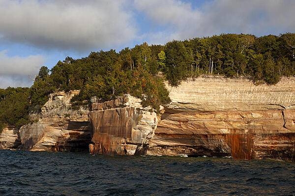
Orange-red sandstone cliffs at Pictured Rocks National Park, Michigan.
Photo courtesy of the CIA World Factbook

Last updated on October 7, 2025
Airspace
In addition to checking the FAA UAS Facility Map or SkyVector or Google Maps one should consider also FAA JO 7400.10G – Special Use Airspace which is an order, published yearly, providing a listing of all regulatory and non-regulatory special use airspace areas, as well as issued but not yet implemented amendments to those areas established by the FAA.
Special Use Airspace consists of airspace of defined dimensions identified by an area on the surface of the earth wherein activities must be confined because of their nature, or wherein limitations are imposed upon aircraft operations that are not a part of those activities, or both. The vertical limits of special use airspace are measured by designated altitude floors and ceilings expressed as flight levels or as feet above MSL. Unless otherwise specified, the word “to” (an altitude or flight level) means “to and including” (that altitude or flight level). The horizontal limits of special use airspace are measured by boundaries described by geographic coordinates or other appropriate references that clearly define their perimeter. The period of time during which a designation of special use airspace is in effect is stated in the designation. All bearings and radials in this part are true from point of origin. Unless otherwise specified, all mileages in this part are stated as statute miles.
Restricted Areas: No person may operate an aircraft within a restricted area between the designated altitudes and during the time of designation, unless they have the advance permission of:
(a) The using agency described in § 73.15; or
(b) The controlling agency described in § 73.17.
These using agencies may be the agency, organization, or military command whose activity within a restricted area necessitated the area being so designated. Upon the request of the FAA, the using agency shall execute a letter establishing procedures for joint use of a restricted area by the using agency and the controlling agency, under which the using agency would notify the controlling agency whenever the controlling agency may grant permission for transit through the restricted area in accordance with the terms of the letter. The using agency shall:
(1) Schedule activities within the restricted area;
(2) Authorize transit through, or flight within, the restricted area as feasible; and
(3) Contain within the restricted area all activities conducted therein in accordance with the purpose for which it was designated.
For the purposes of this part, the controlling agency is the FAA facility that may authorize transit through or flight within a restricted area in accordance with a joint-use letter issued under § 73.15.
Prohibited Areas: No person may operate an aircraft within a prohibited area unless authorization has been granted by the using agency. For the purpose of this subpart, the using agency is the agency, organization or military command that established the requirements for the prohibited area.
Military Operations Areas: A Military Operations Area (MOA) is airspace established outside of Class A airspace to separate/segregate certain nonhazardous military activities from IFR traffic and to identify for VFR traffic where these activities are conducted. Activities. MOA’s are established to contain certain military activities such as air combat maneuvers, air intercepts, acrobatics, etc.
Alert Areas: Airspace which may contain a high volume of pilot training activities or an unusual type of aerial activity, neither of which is hazardous to aircraft.
Warning Areas: A non regulatory warning area is airspace of defined dimensions designated over international waters that contains activity which may be hazardous to nonparticipating aircraft. The purpose of such warning areas is to warn nonparticipating pilots of the potential danger. Activities may be hazardous.
National Security Areas: A national security area (NSA) consists of airspace of defined vertical and lateral dimensions established at locations where there is a requirement for increased security of ground facilities. The purpose of such national security areas is to request pilot cooperation by voluntarily avoiding flight through the NSA. When circumstances dictate a need for a greater level of security, flight in an NSA may be temporarily prohibited by regulation under the provisions of 14 CFR Section 99.7, Special Security Instructions. Such prohibitions will be issued by FAA Headquarters and disseminated via the US NOTAM System.
Crewed Aircraft in your Airspace
CREWED AIRCRAFT
MIDOT
start by checking
Michigan State Drone Statutes
Michigan government website just for reference.
Michigan Legislature in case more laws were written since the book was last updated.
Michigan Agriculture and Rural Development for Part 137 operators.
259.311 Operation of UAS; person authorized by FAA.
259.313 Operation of UAS; manner.
259.320 Criminal liability; offense committed with aid of an UAS; exception.
259.321 Operation of UAS; interference with official duties prohibited.
259.323 Violation as misdemeanor; penalty; other violation of law.
259.330 Michigan aeronautics commission; duties; departmental support.
750.45a Use of UA; definitions.
Local Ordinances and Policies
This list may not be complete. Always check for any local ordinances that may have been published in search engines such as American Legal Publishing and Municode Library since this book was last updated.
East Lansing
East Lansing Code – Sec. 26-68. – Unmanned aircraft.
Michigan Department of Natural Resources
Regulate use of certain managed state lands – Order 2.103
Mt. Brighton Ski Resort
Mt. Brighton Ski Resort Drone Policy
Mount Pleasant
Mount Pleasant Code 97.21 – UNMANNED AIRCRAFT.
Rothbury
§ 92.25 SPECIFIC ACTS PROHIBITED.
Township of Meridian
Wyandotte
Wyandotte Code – CHAPTER 98: UNMANNED AIRCRAFT
University Drone Policies
Saginaw Valley State University
Note: This list is just a sample… many more could be added.
Advanced Air Mobility (AAM) Regulations & Policies
Michigan Department of Transportation (MDOT) Office of Aeronautics (AERO)
Michigan Advanced Air Mobility (AAM) Initiative
2024 – Michigan AAM infrastructure investments include Beta, Skyports
2022 – Michigan state explores autonomous vehicle corridor to reduce emissions
Advanced Air Mobility (AAM) News
2025 – Michigan lab begins testing drone deliveries (VIDEO)
2025 – Avflight Installs Electric Chargers at Michigan Airports
2025 – Michigan grants to advance drone deliveries (VIDEO)
2025 – Michigan seeks to support AAM industry growth
2025 – BETA installs electric-aircraft charger at Michigan airport
2025 – Gov. Whitmer launches Michigan AAM initiative
2025 – Skyports evaluates ship-to-shore BVLOS drone deliveries
2023 – MightyFly receives grant for eVTOL demo flights in Michigan
2022 – EVA connects drone infrastructure to airports in Michigan
Short Essay Questions
Question 1
You have been hired by a Drone Startup Company. Your boss has immediately assigned this job to you.
They need you to prepare a one-page memo detailing the legalities of filming the orange-red sandstone cliffs at Pictured Rocks National Park, Michigan, pictured above.
They need you to mention any state laws and local ordinances.
They specifically want to know what airspace (insert pictures) you will be operating in, and whether or not you need an airspace authorization, with or without LAANC capability.
Lastly, there is a bonus for you if, as you scroll through this chapter, you find any typos or broken links!
Question 2
Do the state drone laws implicate the First Amendment? If so, describe, citing the exact law.
Question 3
Do the state drone laws implicate the Fourth Amendment? Or involve law enforcement officers obtaining warrants? If so, describe, citing the exact law.
Question 4
Do the state drone laws contain a preemption clause? If so, describe, citing the exact law.
Question 5
Does the state have UAM/AAM laws? If so, describe, citing the exact law.
Question 6
Are you aware of any new laws or policies not mentioned above? If so, describe, citing the exact law or policy.
